
How to Start Mountaineering: First Routes in the Andes
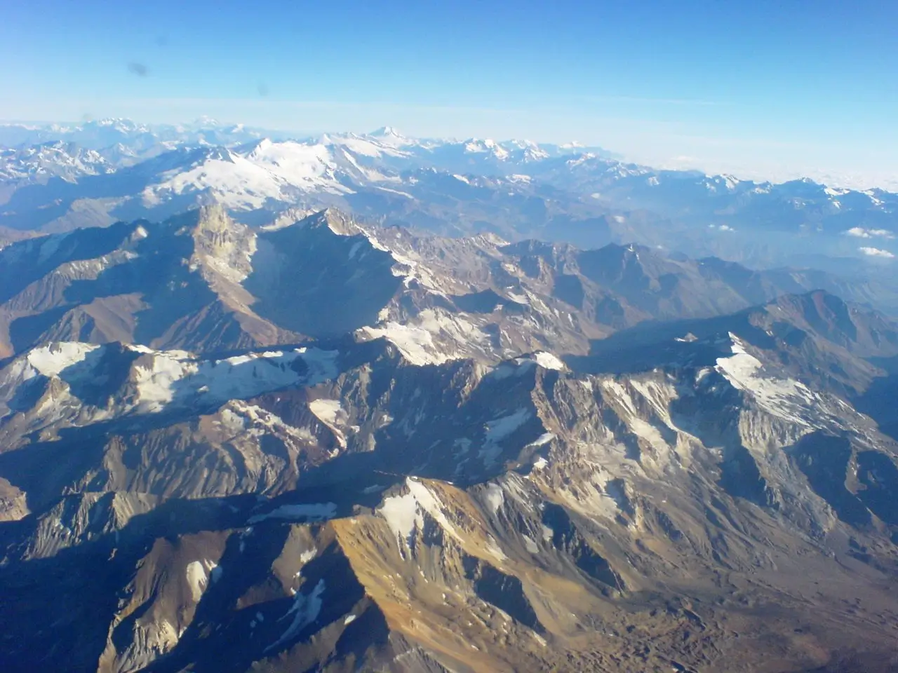
Stretching over 7,000 km along the western edge of South America, the Andes are the longest continental mountain range on Earth and one of the most diverse climbing regions in the world. From Ecuador’s green volcanoes to Peru’s wide ash fields and the high deserts of Chile, the Andes offer landscapes unlike anywhere else. Altitude plays a major role here – even the gentlest peaks rise well above 4,000–5,000 meters – making the range both inspiring and demanding for beginners.
Fortunately, not all Andean mountains require ropes or technical skills. Some offer gentle slopes, wide ridgelines, clear paths and safe terrain, creating ideal training grounds for anyone beginning their high-altitude mountaineering journey. In this guide, we explore four beginner-friendly peaks: Pasochoa, Rucu Pichincha, Cerro Toco and Misti -all of them accessible, beautiful and perfectly suited for a first taste of Andean climbing.
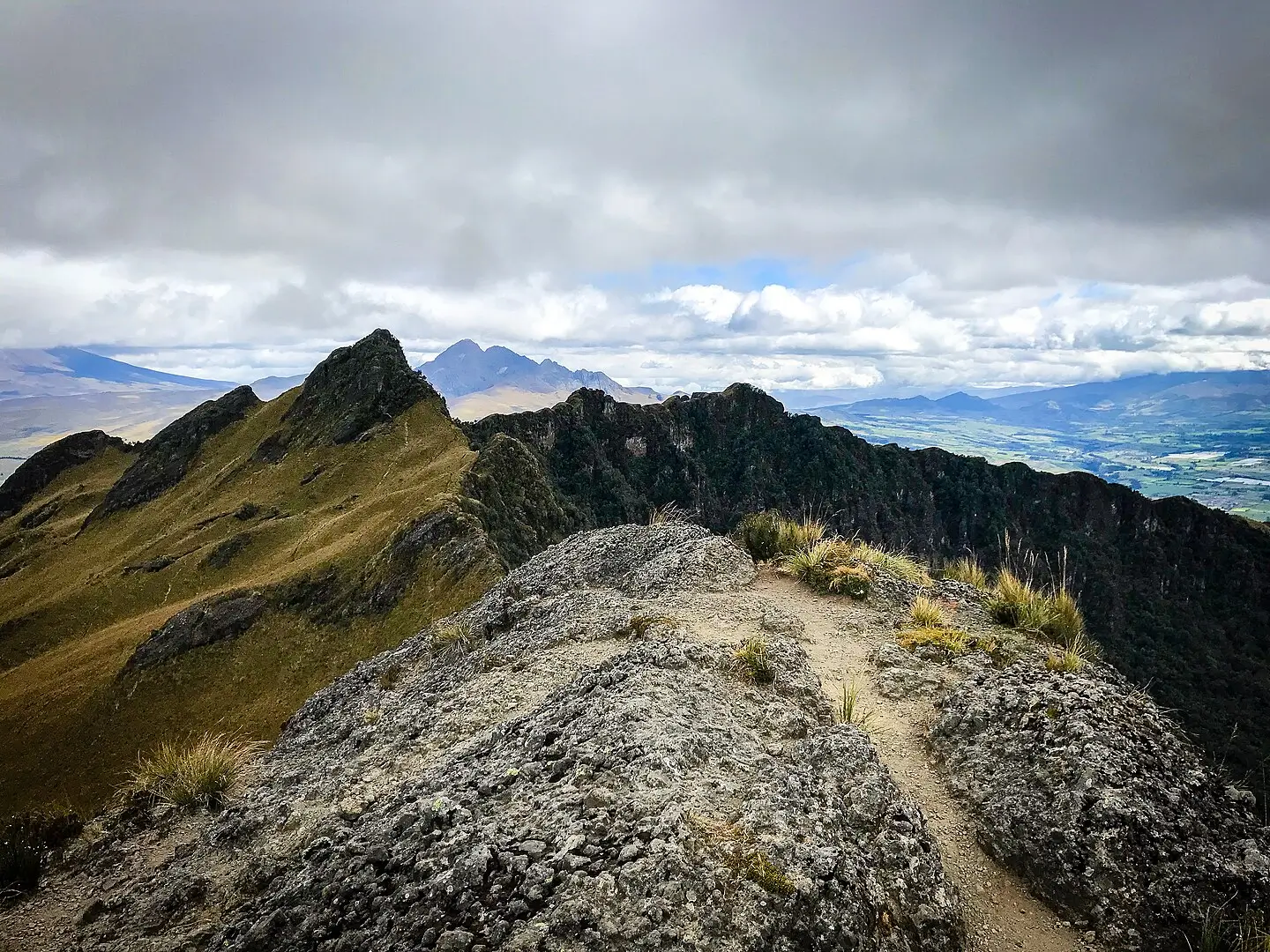
A shot from the Pasochoa’s summit Photo: Diegoandrade
Pasochoa (4,199 m)
A gentle Ecuadorian volcano and a perfect introduction to high altitude.
Overview
Pasochoa is an extinct volcanic crater located just outside Quito, surrounded by rolling grasslands and cloud forests. Because of its mild slopes and straightforward terrain, it is one of the safest and easiest 4,000-meter peaks in the Andes. The ascent feels more like a long alpine hike than a climb, offering open views toward Cotopaxi and the high plateau. It’s often used as an acclimatization peak for bigger Ecuadorian volcanoes.
Access / Base Location
The mountain is easily reached from Quito, with the trailhead located in the Pasochoa Wildlife Reserve. The approach is short and simple, and no special permits or logistics are required. This accessibility makes Pasochoa a popular first peak for new mountaineers arriving in Ecuador.
Easiest Route
The route begins on grassy terrain and gently rises through páramo vegetation toward the wide crater rim. The slope becomes steeper near the final ridge, but the path remains non-technical and intuitive. The summit overlooks the deep crater interior and the iconic snow-covered silhouette of Cotopaxi to the south. The descent follows the same panoramic trail.
Best Season & Difficulty
Best Season: June to September, though it is climbable year-round in good weather.
Difficulty: Easy (Grade T2 / F, Facile).
Duration: 3–5 hours total.
Why It’s Good for Beginners
Pasochoa delivers high-altitude experience without the stress of technical terrain. Its grassy slopes, predictable route and forgiving elevation gain make it one of the best first peaks in the Andes.
Rucu Pichincha (4,698 m)
A dramatic ridge volcano rising directly above Ecuador’s capital.
Overview
Rucu Pichincha is one of Quito’s defining mountains – a rugged volcanic summit accessible by foot or by cable car. Despite its elevation, the standard route is friendly for beginners who have acclimatized. The ascent combines barren volcanic slopes, light scrambling sections and sweeping views across the city. Its accessibility makes it one of the most popular first Andean climbs.
Access / Base Location
Most climbers start from the TelefériQo cable car station in Quito, which lifts you to around 4,000 meters. From there, the trail follows a long ridge system, offering a gradual approach to the summit. This makes Rucu Pichincha one of the easiest high peaks in the region to reach.
Easiest Route
The trail traverses sandy volcanic slopes before rising toward the final ridge, where short scrambling sections appear. These rocky steps are intuitive and manageable, giving beginners a taste of easy hands-on movement. The summit offers exceptional views toward Antisana, Cayambe and the northern Andes. The descent returns along the same ridge.
Best Season & Difficulty
Season: June to September is ideal for clear weather.
Difficulty: Easy to Moderate (T2 / F).
Duration: 4-6 hours total.
Why It’s Good for Beginners
Rucu Pichincha offers a real sense of mountaineering – altitude, ridgelines, scrambling – while remaining safe and straightforward. Its access from Quito makes acclimatization and planning incredibly simple.

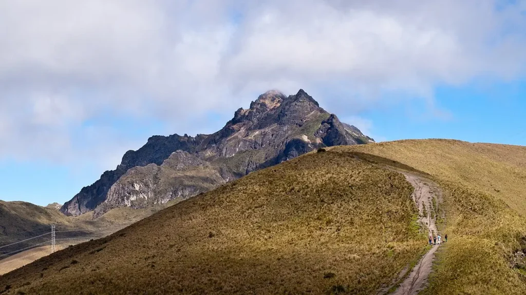
Cerro Toco, Photo: Gerard Prins
Cerro Toco (5,604 m)
A high Andean giant with one of the easiest 5,000-meter routes in the world.
Overview
Cerro Toco rises from the Atacama Desert near the Chile–Bolivia border, dominating one of the driest landscapes on Earth. Despite its intimidating height, it is considered one of the easiest 5,000+ meter peaks to climb anywhere in the Andes. The normal route is a gradual volcanic slope, and the panoramic views stretch across salt flats, smoking volcanoes and the vast altiplano.
Access / Base Location
The climb begins near San Pedro de Atacama, a major adventure and astronomy hub in northern Chile. A vehicle can reach high on the mountain, reducing the approach and making the final ascent short and controlled. This accessibility makes Cerro Toco a classic acclimatization climb.
Easiest Route
The route ascends gently over sandy volcanic terrain, with no scrambling or technical sections. Because most of the effort comes from the altitude rather than steepness, climbers must move slowly and steadily. The summit plateau reveals sweeping desert views, including Licancabur and Juriques volcanoes. The descent follows the same broad slope back to the trailhead.
Best Season & Difficulty
Season: Year-round, though May–October offers clearer skies and cooler temperatures.
Difficulty: Easy (T2 / F), mainly affected by altitude.
Duration: 2–3 hours total.
Why It’s Good for Beginners
Cerro Toco is one of the most accessible high-altitude peaks on the planet. Its gentle terrain and short distance allow beginners to safely experience life above 5,000 meters.
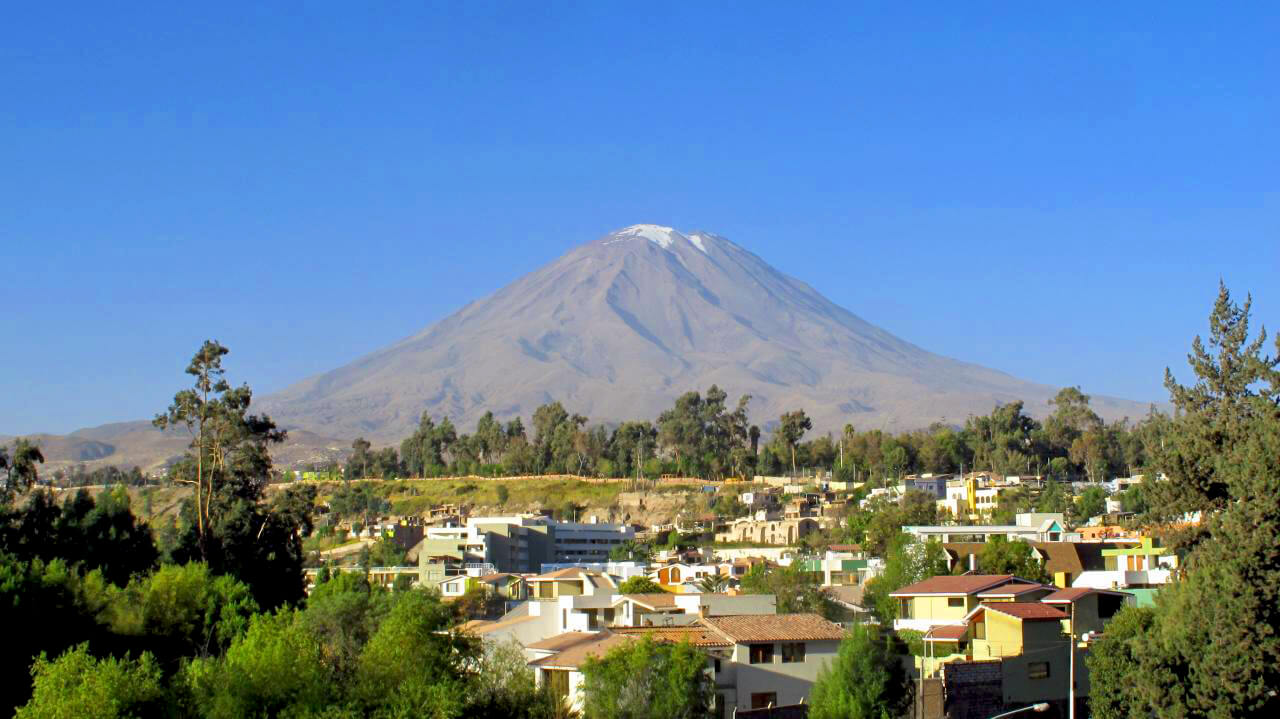
Misti, Photo: Los viajes del Cangrejo
Misti (5,822 m)
A wide volcanic cone rising above Arequipa – a classic Peruvian beginner climb.
Overview
Misti is one of Peru’s most iconic volcanoes, rising in a perfect cone above the colonial city of Arequipa. Its slopes are long but non-technical, making it a popular first high-altitude ascent in the central Andes. The climb offers a true expedition feeling, with ash fields, high camps and enormous panoramic views over surrounding volcanoes.
Access / Base Location
Most climbers begin from Arequipa, where guiding services, transport and equipment rentals are widely available. The ascent typically involves a night in a high camp, though strong and acclimatized climbers sometimes complete it in a single day.
Route Summary (Easiest Route)
The standard route climbs through sandy and dusty terrain toward the high camp at around 4,900 meters. From there, the summit day begins before sunrise, following gentle slopes up the wide cone. Despite the altitude, the path is easy to navigate and non-technical. The crater rim reveals expansive views over Chachani, Pichu Pichu and the desert plains surrounding Arequipa.
Best Season & Difficulty
- Season: April to November, during Peru’s dry season.
- Difficulty: Easy to Moderate (T2 / F) because of overall altitude.
- Duration: 8–12 hours total (or 2 days with a high camp).
Why It’s Good for Beginners
Misti combines expedition atmosphere with safe terrain. It’s an excellent stepping-stone for future high-altitude climbs – long, rewarding and accessible for those who acclimatize properly.
Final
The Andes offer some of the most spectacular beginner mountaineering experiences in the world. With their wide volcanic slopes, clear trails and astonishing views, peaks like Pasochoa, Rucu Pichincha, Cerro Toco and Misti allow newcomers to explore high altitude in a safe, structured way. Each mountain teaches a different lesson – acclimatization, pacing, ridgelines or multi-day planning- making the Andes an inspiring and transformative region for anyone starting their mountaineering journey.

Share this post:


Comments