
How to Start Mountaineering in Europe: Your First Routes in the Dolomites
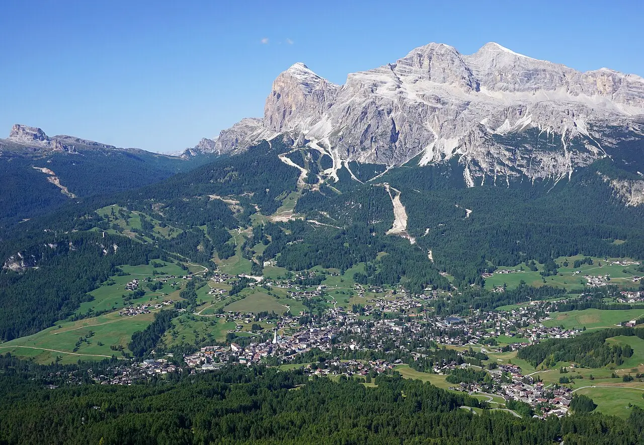
Photo: kallerna – Own work
Regional Overview
If the Alps are the birthplace of mountaineering, the Dolomites are its sculpted masterpiece – a place where limestone turns golden at sunset, where vertical towers rise above alpine meadows, and where every trail feels like a story in stone. Declared a UNESCO World Heritage Site, this region in northeastern Italy stretches across South Tyrol, Trentino, and Veneto.
The Dolomites are uniquely welcoming to beginners. Unlike the glaciated peaks farther west, here you’ll find well-marked routes, modern cable cars, and a network of cozy mountain huts known as rifugios. These features make it possible to step into genuine alpine terrain without needing advanced technical skills. It’s a place where you can safely learn mountain rhythm – the early starts, the steady pacing, the weather awareness – all while surrounded by Italy’s most cinematic landscapes.
In this second part of our “How to Start Mountaineering in Europe” series, we explore four of the most beginner-friendly routes in the Dolomites: Sass Pordoi, Monte Piana, the Croda da Lago Circuit, and Col dei Bos. Each offers its own doorway into the mountains – gentle yet transformative experiences that capture the essence of what makes the Dolomites unforgettable.
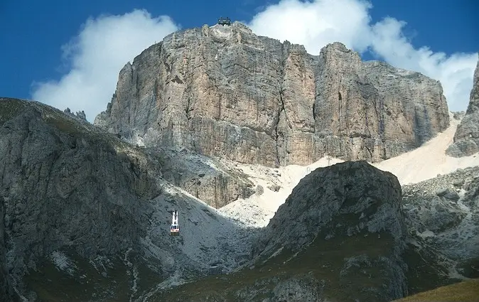
Funivia Sass Pordoi, Photo: Carsten Clasohm
Italy – Sass Pordoi (2,950 m)
Sella Group, Trentino–South Tyrol
Overview
Known as “the Terrace of the Dolomites,” Sass Pordoi provides one of the easiest high-altitude experiences in the Alps. From its panoramic summit plateau, you look across the Sella Group to the Marmolada Glacier and the endless sea of pale limestone peaks.
The climb itself is straightforward: you can reach nearly 3,000 meters via cable car, then walk across the plateau toward Forcella Pordoi and even continue to Piz Boè (3,152 m) -often called the easiest 3,000-meter peak in the Dolomites. It’s a chance to step into thin air, feel the altitude, and taste what true mountaineering feels like – without technical difficulty.
Access / Base Location
The base is Passo Pordoi (2,239 m), a high mountain pass between Canazei and Arabba. Parking is available directly at the cable car station (Funivia del Sass Pordoi), which operates from late June to early October. The upper station (2,950 m) immediately opens to the vast rocky plateau. Those seeking more adventure can stay overnight at Rifugio Forcella Pordoi (2,829 m), a short walk from the top, surrounded by endless Dolomite cliffs.
Easiest Route
From the cable car station, follow Trail 627 toward Forcella Pordoi – a well-marked rocky path leading to the pass in 30-40 minutes. From there, you can continue toward Piz Boè, a short, easy scramble (Grade I) on solid rock. Expect 1-2 hours to the summit and another hour for the return.
Best Season & Difficulty
Best Season: Late June to early October
Difficulty: Easy (Grade T2 / F, Facile)
Duration: 1-3 hours total
Why It’s Good for Beginners
Sass Pordoi combines altitude, accessibility, and reward in perfect balance. You’ll learn how to move on rocky alpine terrain, manage short scrambles, and enjoy the security of nearby huts and lift access – all while standing at the edge of one of Italy’s grandest landscapes.

Italy – Monte Piana (2,324 m)
Sexten Dolomites, Veneto
Overview
Monte Piana is a mountain steeped in both natural beauty and history. Located just above Lake Misurina, opposite the iconic Tre Cime di Lavaredo, this broad plateau was a front line during World War I. Today, its gentle terrain and breathtaking views make it one of the best introductory climbs in the eastern Dolomites.
As you hike past preserved trenches and stone shelters, the summit opens to a panorama that stretches from the Drei Zinnen to the Cadini peaks – a stunning reward for a relatively simple ascent.
Access / Base Location
Start from Misurina (1,756 m), a small alpine lake village about 15 minutes from Auronzo. In summer, jeep shuttles run from the parking area to Rifugio Angelo Bosi (2,205 m), located near the summit plateau. Those preferring a longer walk can follow the old military road to the hut (about 2 hours).
The rifugio serves as both a base and a viewpoint – ideal for a coffee stop or sunset photography before the return.
Easiest Route
From Rifugio Angelo Bosi, follow the broad, marked trail across the Monte Piana plateau toward the summit cross. Along the way, explore open-air museums of WWI relics. The hike takes 1.5–2 hours round trip, with minimal elevation gain.
The trail is non-technical and suitable for families, though the plateau is exposed to wind and weather, so conditions can change rapidly.
Best Season & Difficulty
Season: June to October
Difficulty: Easy (T1–T2)
Duration: 1.5–2 hours
Why It’s Good for Beginners
Monte Piana introduces you to high-altitude terrain without steep climbs or exposure. You can practice route-finding, pacing, and basic weather awareness – while absorbing the emotional atmosphere of a mountain that witnessed history. It’s both a scenic and reflective journey into the heart of the Dolomites.
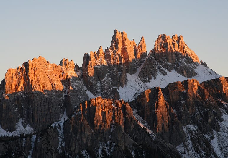
Il versante settentrionale della Croda da Lago, Photo: Nicolò from Italia – La croda da lago al tramonto
Italy – Croda da Lago Circuit & Becco di Mezzodì (~2,300 m)
Cortina d’Ampezzo Region
Overview
Few routes capture the romantic image of the Dolomites as perfectly as the Croda da Lago circuit. This trail loops around the turquoise waters of Lago Federa, beneath the spire of Becco di Mezzodì, one of the most photographed peaks in Italy. It’s a full-day mountain adventure that feels like stepping into a postcard – varied, beautiful, and achievable for beginners with moderate fitness.
Access / Base Location
The circuit begins at Ponte de Ru Curto (1,700 m), about 15 minutes from Cortina d’Ampezzo. There’s parking at the trailhead or shuttle access in high season. Many hikers base themselves in Cortina, the Dolomites’ mountaineering capital, with countless gear shops and guides. Those who wish to extend the experience can stay overnight at Rifugio Croda da Lago – G. Palmieri (2,046 m), on the shores of Lago Federa.
Easiest Route
Follow Trail 437 uphill through pine forest to Lago Federa, then continue to Forcella Ambrizzola (2,277 m) for panoramic views of Becco di Mezzodì and the distant Marmolada. From here, loop back via Trail 434 to complete the circuit. The total distance is about 10 km with 700 m elevation gain, taking 4-5 hours. The path is well maintained, alternating between gentle ascents, rocky sections, and grassy slopes.
Best Season & Difficulty
Season: Late June to mid-October
Difficulty: Easy–Moderate (T2–T3)
Duration: 4-5 hours
Why It’s Good for Beginners
This loop gives you a real taste of alpine movement – steady uphill walking, changing terrain, and a rewarding sense of accomplishment. The scenery is world-class, the rifugio offers comfort and warmth, and every turn feels like a photograph. It’s the Dolomites’ perfect beginner adventure.
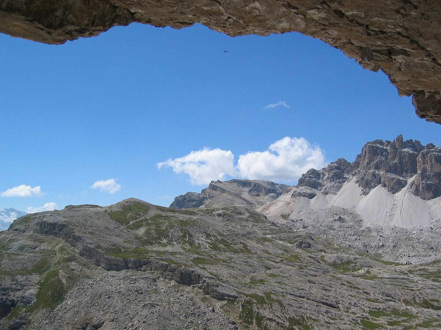
Italy – Col dei Bos (2,559 m)
Fanis Group, near Passo Falzarego
Overview
Col dei Bos is a compact, accessible peak that offers one of the most rewarding short climbs near Cortina. Rising above Passo Falzarego, it’s a half-day outing with all the ingredients of real mountaineering: a summit ridge, big views, and the satisfying rhythm of the ascent – yet without ropes or technical climbing.
Access / Base Location
The route begins directly from Passo Falzarego (2,105 m), reachable by car or local bus. Parking is plentiful at the pass, and the trailhead is clearly marked. The climb can easily be combined with a visit to Rifugio Lagazuoi, one of the region’s most famous viewpoints, reached by cable car from the same pass.
Route Summary (Easiest Route)
Take Trail 402 toward Forcella Travenanzes, then follow signs to Col dei Bos. The trail ascends steadily across rocky terrain, then curves onto a ridge leading to the summit. Total time: 2-3 hours round trip, depending on pace. The path is straightforward but exposed to the sun, so an early start is recommended. The route can also serve as an introduction to nearby easy via ferratas, such as Via Ferrata degli Alpini, for those seeking progression.
Best Season & Difficulty
- Season: June to October
- Difficulty: Easy to Easy-Moderate (T2–T3)
- Duration: 2–3 hours
Why It’s Good for Beginners
Col dei Bos offers a pure mountain experience without risk. You’ll climb steadily, feel the altitude shift, and stand on a summit with an unforgettable panorama – all within a safe, half-day trip. It’s an ideal first mountain for anyone wanting to transition from hiking to true mountaineering.
Final
The Dolomites teach balance – between beauty and challenge, between comfort and adventure. Here, you can move safely through landscapes that feel both ancient and alive, learning mountain rhythm without fear or pressure.
Whether you stand on Sass Pordoi’s terrace or circle Lago Federa beneath Becco di Mezzodì, each step introduces you to what mountaineering really means: patience, awareness, and awe. Start with these four routes, listen to the mountains, and let them guide your first ascent – one sure-footed step at a time.

Share this post:


Comments